
turboplanner
-
Posts
24,945 -
Joined
-
Last visited
-
Days Won
161
Content Type
Profiles
Forums
Gallery
Downloads
Blogs
Events
Store
Aircraft
Resources
Tutorials
Articles
Classifieds
Movies
Books
Community Map
Quizzes
Videos Directory
Everything posted by turboplanner
-
........termite was ooozing a sticky, poisonous liquid and saying "Banzai!, Banzai! 私はナンバーワンです". A wild deer came down for a drink and accidentally squashed the termite. A Japanese orderly walked the trail pretending he was a Samuri. He stopped to drink and, as the Japanese do, sprayed the whole area with Staph disinfectant. The staaph infection was wiped out, and that little acorn is now big and strong and waves with the others as the new Samuri walk the trail which has never seen a motor vehicle.........
-
You're right. I attached my answer to thr wrong quote. This was the correct quote: "Ask Jack Vevers. Stale fuel belongs in Lawn Mowers, Nev"
-
Stale fuel can stuff lawnmower carbies depending on the fuel blend; the lower level octanes (cheaper) contain ethanol which gums up galleries. If all the galleries are screw sealed, you can clean it out. If the galeries are cast then part bored, new carby required. Highest level octane has no ethanol but the aromatatics evaporate off to the point where you can't start the engine. Aromatics can be recharged with a small amount of fresh fuel. My advice is (a) Go back to the full discussions on this site then (b) work on what the manufracturer of your engine says. He knows what's going to get blocked and what isn't.
-
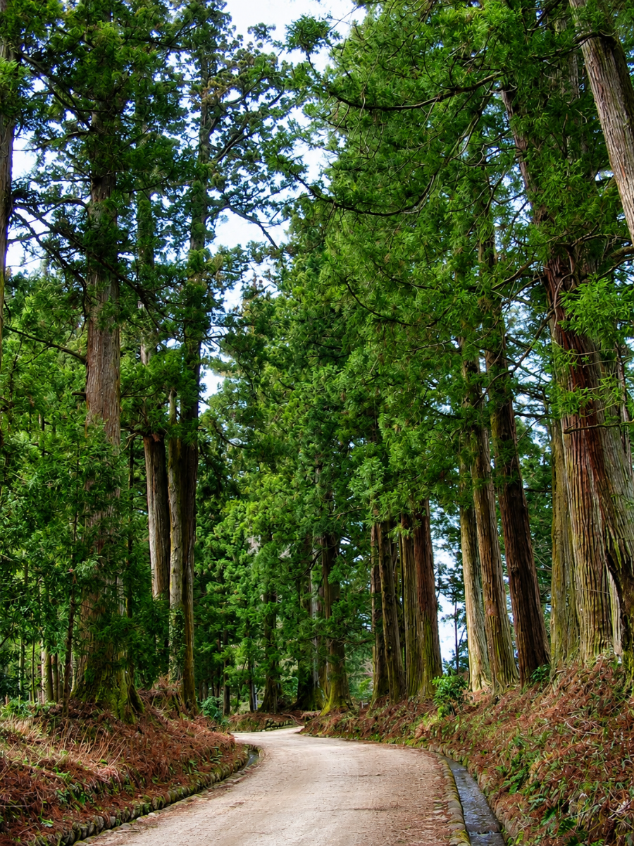
..........Cappy knew nothing, hence the prolific posts about gender. Cappy is very similar to Alan Joyce; they can become precious at times but are in the seat when duty calls.Cappy certainly messed up knowing which seat in the Khyber businessleaving Turbo with ongoing pain, but he tries. Not many people know this. but Turbo was invited by the Emperor of Japan to train as a Samurai warrior. This included running along the Samurai Trail naked. As you can see, there are little streams running the full 200 km marathon length, for left or right handed people. These are swept clean every night to ensure Samurai only drink clean water. Every kilometre there is a Shrine and a Priest may bless you, or thrash you with those tree fronds. If you make the finish, they plant a tree for you. Turbo's is only small, but.....................

-
.....go, but as long as they ran around inside the fence, Albo style, it was just a dream, so the camp came alive with ideas to escape. One idea was to go out in the sewerage because Australian guards would never look there, and dozens of straws were save from the canteen, another was a distraction, and four............................... That was before the operation.
-
.......be exposed with Cooks Tours blasted in the media for shipping out thousands of escaped prisoners, or even ..................... Turbo was trying to turn the page but suspects that EEn uses elastic pages.
-
......Organise a party Saturday night. These parties had a bad habit of lasting until the early hours of Monday morning, but more about that later. Cappy has raised an interesting detail in "Mabel from the 8-mile farm." This piece of war history is still under the Official Secrets Act, and nothing has ever been released. NES Readers are recommended not to loosen their lips about this piece of history because Australia has precious few Warships left, and the Rougue SAS ex soldiers are hired to shut people up. However Turbo is prepared to take the risk, out of pride in Mabel Buttock, Australia's version of Schindler and his list. Mabel didn't have a very happy schooling being the butt of many jokes and catcalls of "They're SMALL", but this made her tough. She spent most of her day in the library until School Bus time for the run out to the 8 - mile Farm. Her parents were in the cropping and sheep business. Turbo had the pleasure of flying over the 8 - mile farm a week or so ago and it's as pristine as it was in WW2. Dingo Gully, which sheltered the little columns of Jap prisoners as they were escorted to freedom has not been degraded by the erosion, which is a credit to Mabel's son Saito Buttock and Grandson Minato Buttock. When WW2 was at its height, Mabel had ridden a horse into town to watch the film Schindler's list. It was said she was very thoughtful after that, and without telling anyone, got an old binder out of the shed and cut 20 acres for straw. Her father Gordon McTavish Buttock was bemused at this but she said she wanted the hay for the horses, and that's what Gordon told the neighbours. People who have travelled to Japan will remember going to night clubs and seeing the sextet dancers. There were only two dancers but the cleverly arranged structure each was tied to contained two extra Straw Men. [For NES readers this is where the "Straw Man" argument comes from.] Mabel started smuggling straw men into the camp two by two, with the Straw Men dressed as cleaners the same as Mabel. No one looks at Cleaners, and the Australian Guards ignored them, (They were from Queensland and Tasmania). Six hours later three cleaners strolling out through the gates didn't ring any bells, and at the 8 - Mile, Mabel started Australianising them with the Queensland clothing of the day, Brylcreem, and spray tan in a dark shade, so they looked like Queensland Cane Knackers. They then had to ride up the gorge, over the secret trails of the Great Divide and down into Wollongong, where everyone else looked the same anyway. From there it was a ship to Malaya where they stayed at a Turbine Resort for the rest of the war. In fact they stayed on three years after the war until Grantley Turbine booted them out. In this way Mabel Buttock saved three thousand lives, and after the years of Tech School in Malaya many came back to Ford and were the backbone in producing the Ford Falcon. Not many people know that Mabel Spent her last years in the Royal Suite of Melbourne's Windsor Hotel, paid for by Cappy's father who .....................
-
.......the chooks tend to peck at the wiring and fill the Drifter with feathers, and their chook live for some reason like the seat cushions so on anything more than a 15 minute flight the occupants are scratching...........
-
.........Cappy will not repeat the same mistake as his ancestor and start touching up the local hula dancers. Cappy was one step ahead of that episode, he never went more that three steps from the encabulator powered Drifter he'd resurrected from .....
-
....could blame them; it's not every day you're confronted with a blue face and a big sword. Not many people know that when Mel had his farm out of Albury, Turbo was his equipment advisor. He had the best utes in the district, and at one time asked Turbo to build him an Ultralight. At that stage Recreational Aircraft were just that. There were none of these faux Cessnas around which confused most of the general public. Turbo stayed up on the property for a week, starting with a length of Aluminium Irrigation pipe and hanging together quite a neat frame. Wing Covering came from Dean St Blinds which created aa slight weight issue but this was offset by selecting an aircooled JAP swing saw motor which could cut down big trees, then with its single gear to the wheels, tow the logs to the saw benches. It was a little bit hard to see over the top of the Jap, but Mel said he didn't mind; he'd had to drive weird machines where you sometimes couldn't see and had to rely on the Director. He was driving one of these monsters one day doing everything the Director said, when he said "Two sugars in mine" NES readers would appreciate that in remote driving that would have been hard, and Mel hit the local sewerage truck. He flew the Freedom (named by Turbo), all overs the property and was one of the Movers and Shakers in getting Holbrook up. Then he became famous and for years the Freedom was hanging on the roof of a local latte shop. In later years.......................
-
..............freedom. Some blue-faced Scot went to a rally on the steps of Parliament House, but ..........
-
............and some who had alway gone to Vinnies for ther $2 clothes (because the poor people didn't need them if there was so much in the shops, began dressing up. Soon whole suburbs were changing there ways and you didn't see too many people going to funerals in T Shirts, shorts and sandals any more. People even....................
-
......manipulate all the coffee shops to show the Daily Turbine News, which of course was quite different to the Left diatribe. The customers appreciated it and told their friends who started going to the coffee shops for new, and they started dumping their EVs, taking their roof solar systems to the tip, and buying real clothes. It was said that ..................
-
.......ink and sold through coffee shops as TurboInk. It wasn't long before the latte set were ordering a shot of TurboInk with their chosen coffee. Sales increased exponentially when Turbo hired skinny girls (must have teeth) who posed for photos telling how they were fat and never though they would get a gut until TurboInk shots came along. And it wasn't long before ............
-
...........Rachel......", but it was too late; Rachel wasn't, saw what was coming, walked away and went to the Press...................
-
....clamping her tongue in a vise. "Plthsth Excrame" came the inevitable answer, but .................
-
.....want to hesitate, so she asked "Please Eexplain". It was too late; in an instant the ranga Raachel had her in a jaw grip and marched her out onto the street.....................
-
a chair to shave,never brushed his teeth, aandwas a mysoginist,agenuine one - not like us accused, who decided take BigRed (as Pauline was known); he posted crap about her, argued with anyone who disagreed, called any defenders XXXXXXXs and generally made a nuisance of himself. This was not a good start to taking down Prime Minister, and BR had her admirers who .........
-
.......then filled with what looked like genuine voting slips,and the boxes delivered the same way as AEC does. Dominion also provided a box minder, so when the second (AEC) batch arrived they were moved into the voting area, but when it was time for the count, the Dominion boxes came out. The scrutineers commented that this was the first year no informals had been received, but then just went ahead and signed off. Now there was a little Hitler, who...................
-
......Governor General. She was still smarting from the way the President showed her up on his arrival by snapping to attention (she didn't know what attention was) and marching along the Guard line with a complement here, licking his finger and getting a stain off there, and realised all she could offer them was fish and chips. She started to wonder whether it was all worth it, then Albo came along on his Government issue electric scooter, giving her a snarl, and she knew the power of the ballot box. The problem was that all those ballot boxes had been........................
-
.......invited the Greens to a BBQ. Such was the status of this once powerful Party. Four fights broke out oveer how they would ever get a vote again, and there were plenty of ribs at .........................
-
The Vatican is watching the number of pages very carefully. No one has ever succeeded in writing more pages than VaticanScribes Inc.
-
.......realised the typical evasion of an Academic. "I have to do ALL the work around here!" she moaned, and then realised she had to put make up on and go out to the airport to greet the President of Tuvalu..............................
-
...........take over the Precinct Fish and Chip Shop, and baring her teeth at the thought, would as a first action paint over the "fries" sign and write "chips". This Prime Minister was going to fix every little issue. Of course, in handling all portfolios, she had 78 "Yes Ministers" (YMs) to deal with. There were usually 30 of them sitting on a bench outside the Prime Ministerial office, all academics,and aas we know it was an academic that drowned in a creek of average depth 1 metre. Every question he asked, they answered with "Yes" followed by a long and evasive trail that left her asking "Please explain"..........................................
-
.......no one turned up. "Please explain" she said to the whips. "Well, Madam Prime Minister, you said you could be the government, and the people only voted for you, electorate by electorate, so here you are - the Prime Minister of no one." Pauline became unsure but still..............