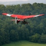
danny_galaga Posted 14 hours ago Posted 14 hours ago So, I really should get my arse into gear and get this ticked off, now I'm flying my plane. So, what I want to do is learn as much as I can on my own, since there is no flying school nearby anymore. There is a guy at my hanger who is happy for me to come flying with him so I can actually practice navigation. His plane has roughly similar performance to mine which is helpful (because we both have SLOW planes 😄 ) . He isn't an instructor though. I am a slow learner so I feel if I do as much of this as possible before I try and find an instructor, the better. So with that in mind, and bearing in mind I find it harder to study nowadays, would this book be the simplest way to get the endorsement under my belt? https://raaus.com.au/product/raaus-cross-country-book-only-bob-taits-aviation-theory-school/
T510 Posted 13 hours ago Posted 13 hours ago (edited) I did my navigation theory exam a couple of weeks ago. I have the Bob Tait book and worked through it but found Pilot Practice Exams course and practice exams much easier to retain. https://www.pilotpracticeexams.com/ra-aus-theory-course/ Edited 13 hours ago by T510
facthunter Posted 13 hours ago Posted 13 hours ago His stuff is quite well regarded.. Met info was never easy to obtain. I know of no single comprehensive reference for Met. Air Law needs to be current. Flying with Other pilots X country is always useful provided you don't pick up any bad habits Compile a small note book of all the rules you must remember. . Do a flight Plan copy and do your Own entries and estimate ETA's and fuel endurances. You can enter it in your Log Book But it doesn't count as flight time Nev 1
BurnieM Posted 13 hours ago Posted 13 hours ago (edited) I had the Bob Tait book but I found this book by Dyson-Holland to be better - Dyson-Holland book You probably want to purchase paper copies of your local VNC/VTC charts. You could do a couple of nav exercises with another pilot but naving and flying on your own will be very different. Edited 13 hours ago by BurnieM
facthunter Posted 13 hours ago Posted 13 hours ago The Learning process with these things is Never ending. Nev
Blueadventures Posted 12 hours ago Posted 12 hours ago 2 hours ago, danny_galaga said: So, I really should get my arse into gear and get this ticked off, now I'm flying my plane. So, what I want to do is learn as much as I can on my own, since there is no flying school nearby anymore. There is a guy at my hanger who is happy for me to come flying with him so I can actually practice navigation. His plane has roughly similar performance to mine which is helpful (because we both have SLOW planes 😄 ) . He isn't an instructor though. I am a slow learner so I feel if I do as much of this as possible before I try and find an instructor, the better. So with that in mind, and bearing in mind I find it harder to study nowadays, would this book be the simplest way to get the endorsement under my belt? https://raaus.com.au/product/raaus-cross-country-book-only-bob-taits-aviation-theory-school/ Clifton has been mentioned before, if it suits find out what learning material they recommend. Lone eagle is a good experienced school. 1
Kiwi Posted 10 hours ago Posted 10 hours ago (edited) Plan your own 25nm Nav. Try Boonah to Grandchester (24 nm) Then to Lake Maroon (33 nm) Then Tamborine Village (32 nm) and finally back to Boonah (25 nm) You are never more than 25 nm from Boonah and get a 4 leg nav of about 1.5 hours. I used to similar navs out of Archerfield when I was training. Edited 10 hours ago by Kiwi 2 1
BurnieM Posted 9 hours ago Posted 9 hours ago And you need to do it all using paper charts, compass and watch. No grabbing a quick look at your EFB. Then once you get your endorsement you will never use paper charts again 🙂
PureCaboose Posted 9 hours ago Posted 9 hours ago I do the same thing around YMIG (Mittagong), where I fly up to YWBN (Wedderburn), out to the coast and down to YSHL (Shellharbour), skirt the restricted zone around YSNW (Nowra) and up over the escarpment and then follow the 23nm circle around to ther west, and comeback into YMIG to the south of the Camden training area. I do it clockwise, counter clockwise, count my time, count my fuel etc. 1
PureCaboose Posted 9 hours ago Posted 9 hours ago 1 minute ago, BurnieM said: And you need to do it all using paper charts, compass and watch. No grabbing a quick look at your EFB. Then once you get your endorsement you will never use paper charts again 🙂 Paper charts, pencil/pen and paper for log, and a wiz wheel not the calculator/electronic version. I do use a big number calculator for the math as I am hopeless with math these days, especially when calculating groudn speed. 1
Recommended Posts
Create an account or sign in to comment
You need to be a member in order to leave a comment
Create an account
Sign up for a new account in our community. It's easy!
Register a new accountSign in
Already have an account? Sign in here.
Sign In Now