Garfly
-
Posts
3,242 -
Joined
-
Last visited
-
Days Won
81
2 Followers

Garfly's Achievements
Well-known member (3/3)
-
Juan shows just how complicated it's become:
-

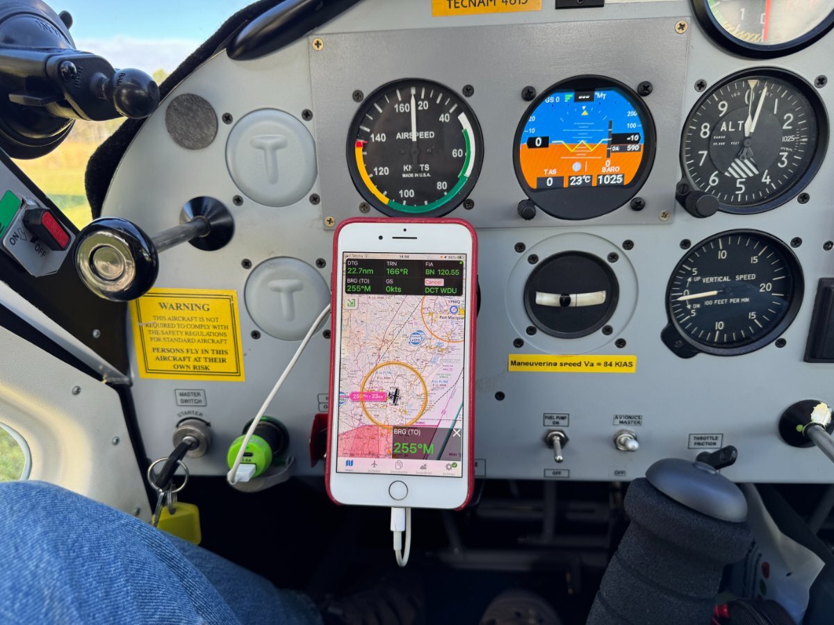
Lest we take EFB moving maps for granted ...
Garfly replied to Garfly's topic in AUS/NZ General Discussion
No issue there ... 🔎 -
Lest we take EFB moving maps for granted ...
Garfly replied to Garfly's topic in AUS/NZ General Discussion
Yeah, a phone mounted over the vacant hole'd be a bigger, better, cheaper way. (And for dedicated old-schoolers, there's always a refurbed Ferranti - with built in magnifier ;- )
-
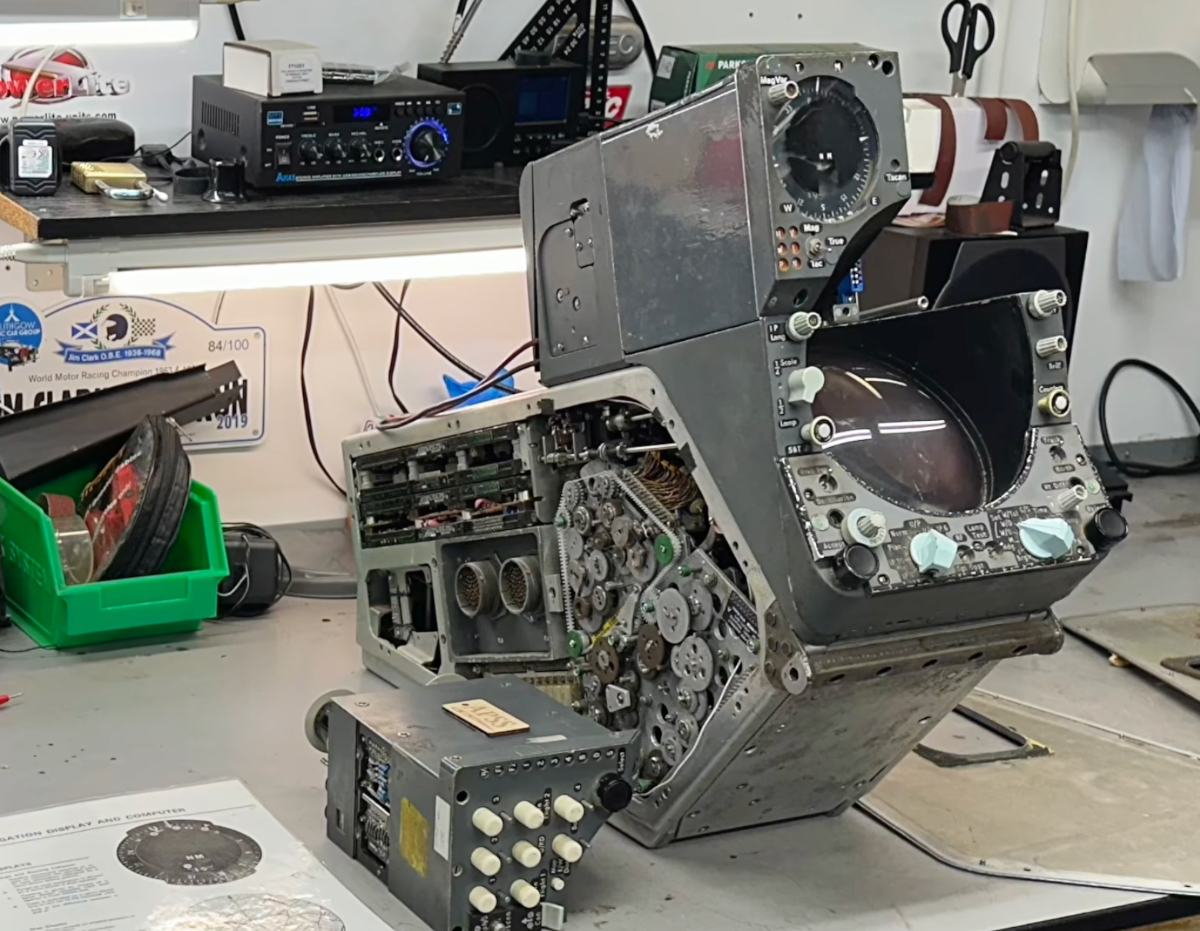
Lest we take EFB moving maps for granted ...
Garfly replied to Garfly's topic in AUS/NZ General Discussion
All that's old is new again! CLICK FOR FULL SIZE: https://uavionix.com/skyplay/?srsltid=AfmBOopRrx5GgNQKzFSt-kUdvmLiTRilqJK1BZZ4gqt-rzp0iYYUFXQ7
-
here's what Harrier pilots made do with in the early 70's. The system used inertial nav and the rear projection of 35mm film strip photos of aeronautical charts. L
- 7 replies
-
- 10
-

-

-

-
There are often interesting answers to such questions buried in the details when - and if - they emerge. I can't find the Kalgoorlie incident but there was the 1971 case of the Ansett/MMA F28 landing out of gas on the small Fitzroy Crossing gravel strip at night. https://en.wikipedia.org/wiki/MacRobertson_Miller_Airlines Fokker F28 Flight MV 372 Perth to Port Hedland – 30 July 1971, VH-FKC: During the long, late-night hop, destination and onward airports became blanketed with fog. The F28 became dangerously low on fuel, and after circling for some time, Captain Harold Rowell considered ditching the aircraft in the ocean. However, he eventually landed the jet on a gravel runway in the isolated town of Fitzroy Crossing, landing with less than ten minutes of fuel remaining. No life was lost, and no injury occurred. The story is well told in this PPRUNE post: Forty years ago today ... - PPRuNe Forums WWW.PPRUNE.ORG The Pacific: General Aviation & Questions - Forty years ago today ... - ... the people of the tiny Fitzroy Crossing town in the Kimberley region of Western Australia were awoken to the frantic news that an MMA F28... It concludes: Sadly enough, he got nothing but criticism from the company for proceeding to Derby, even though the forecast was clear, and he was very hurt for many years afterwards by their attitude. The big wheels from Ansett in the East came swarming in to smarten up this “little hick airline”, but no matter what anyone could say, Harold had done a magnificent job in utterly impossible circumstances. Personally, I still think he should have been awarded a George Cross, or as it is now, The Star of Courage.
-
Yes, maybe he was thinking they'd avoid the paperwork and squeak-in just fine without 'fessin up. Still and all, it was a good call when that difficult choice was sprung on him. The system worked without a lot of fuss. He ends up with twice the paperwork, but nothing's bent.
-
An interesting example from Vegas the other day: https://www.youtube.com/watch?v=DG-WTepSHaA
-
You're always able to say unable.
-
Not to worry lads. Them what wants it'll work it out. Them what don't can carry on regardless. (And no one's mayday will go unheeded due any of it.)
-
New Garmin G3X Touch efis replacement ?
Garfly replied to BurnieM's topic in Instruments, Radios and Electronics
I see that that the wee CubCrafters bush plane comes with colour TV these days - and a turbine motor too, if you like. I reckon you could land one of those here for not much more than a mill and a bit Pacific pesos.
-
New Garmin G3X Touch efis replacement ?
Garfly replied to BurnieM's topic in Instruments, Radios and Electronics
I think you have to register for Van's Air Force these days. -
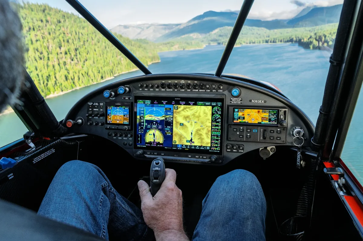
The next leg of the Big Lap Video from Slinging Down Under.
Garfly replied to Garfly's topic in Trips/Events/Seats