

old man emu
-
Posts
5,297 -
Joined
-
Last visited
-
Days Won
78
Content Type
Profiles
Forums
Gallery
Downloads
Blogs
Events
Store
Aircraft
Resources
Tutorials
Articles
Classifieds
Movies
Books
Community Map
Quizzes
Videos Directory
Posts posted by old man emu
-
-
The parcel of land is 40.62 hectares (100 acres), according to the Wollondilly Shire Council records.
At Bringelly, closer to the Badgerys Creek Airport, there is a 2.01 hectare site (with 2 dwellings returning $560 per week in rent) on the market for $4.6 - $5 million. That's $2.3 - 2.5 per hectare. The Oaks Airport is said to be on the market for $10 million, or $250,000 per hectare. Why the lower price? Because the land is not fit for residential nor industrial building.
Not far away, just outside The Oaks is a 28.75 hectare (71 acre) house and land for $3.375 million.
-
 1
1
-
-
Nick Lower, Savills' director of metropolitan and regional sales, said that while a sale ‘‘as-is’’ was possible there was also significant upside for an industrial or residential development, particularly given its proximity to the new Badgery’s Creek Airport.
Never let the facts get in the way of a sales pitch! See my Post #3 for a description of the site.
Proximity to Badgerys Creek Airport - approximately 40 kilometres on single lane, each way, rural roads of poor layout and lousy uneven surface.

A big image of the location of Badgerys Creek Airport
-
I got a biography of an Australian WWll airman for Father's Day, too. I'll talk about it when I've finished reading it.
FATAL MISSION - The life and death of the crew of "Naughty Nan" - 467 Sqn RAAF - by Mal Elliott (ISBN 978-1-922265-14-2) Published by Big Sky Publishing Pty Ltd, Newport NSW
https://www.bigskypublishing.com.au/
This is the story of Australian Oscar Furniss, from Wentworth Falls in the Blue Mountains of NSW, and the crew of Avro Lancaster lll, Production No. JA901, 467 Squadron ID PO-N, nicknames "Naughty Nan".
The book, while telling Furniss' story, provides some information on the way aircrew were selected and trained under the Empire Air Scheme. Starting out as Furniss' story, it takes in the backgrounds of the other crew members, and Naughty Nan's difficult service life.
About 12:15 AM on 4th May 1944, Naughty Nan was shot down after bombing barracks near Mailly-le-Camp, France, which the 21st Panzer Division was occupying. Only two of the crew were able to evacuate the aircraft which was on fire after having been attacked by a night-fighter. Furniss went down with the plane.
The story does not end with the crash. It tells what happened to the two survivors, and the families' efforts to locate their Loved Ones' resting places.
An easy to read book of 200 pages. It contains many photographs, but the reproduction of many is poor. However, some of the photographs illustrate the ways and means that the Allies tried to assist downed aircrew to evade capture.
-
 1
1
-
-
Perhaps not one of the "worst", just too early in the evolution of military monoplanes.
https://www.warhistoryonline.com/instant-articles/fairey-battle.html
by the time the Battle had entered service, its features had been rendered entirely obsolete by the fast advancement in aircraft technology at the time.
Its original specification issued by the British Air Ministry in April 1933 was not commensurate with the needs of 1940.
The birth of the Battle came after the issuance of Specification P.27/32 . The Specification required a monoplane day bomber that would have the capability to carry 1,000 lb bombs over a 1000-mile range at 200 mph. This aircraft would ultimately replace the Hawker Hart and Hind biplanes which were in service with the RAF.
-
Another meeja misrepresentation!
The Oaks airstrip lies alongside Werriberri Creek, which, as creeks tend to do, runs along the bottom of a shallow valley that it has cut for itself over the millennia. The residential areas of The Oaks are along top and eastern side of the ridge to the east of the valley. To the west of the strip, the valley wall rises quickly towards another ridge line to semi-rural properties. The Werriberri Creek drains an extensive watershed before reaching the southern boundary of the airfield. After passing the strip, the valley widens somewhat to form a small floodplain.
Although there has been appreciable residential growth in The Oaks in recent years, that growth has been along the eastern ridge. West of the airport, and across the valley from the main township, development to has not occurred for many years.
Here is a link to the site and zoning details for The Oaks Airport. https://maps.wollondilly.nsw.gov.au/Intramaps96Public/
As I see it, since the airfield is heritage listed at the moment, and is part of an extensive watershed, I can't see its being consumed by little boxes made of ticky-tacky.
-
1
-
-
-
Actually, he bogged it whilst taxying to the take-off point. Clearly a black mark against the operators of the airstrip - failing to mark unserviceable areas.
We were at our Eurong landing strip and two planes were taxiing in company with one other. "The first plane stopped to turn and get into take-off position, the second went to the bottom of the beach to turn around and come up behind the other.
And I won't try to say the name of the strip. There's too many of you who would jump in to correct my pronunciation.
-
1
-
-
Did you see the Light Horseman (circled) making off with the saddle off that nightmare?
-
I got a biography of an Australian WWll airman for Father's Day, too. I'll talk about it when I've finished reading it.
-
The statement about the frequency of sand bogging is going to do nothing to improve the operators insurance premiums.
Good Grief! Imagine the profit insurance companies would get if they upped the premiums for 4x4 vehicles to cover the risk of getting bogged!
-
This is the FAA Advisory Circular:
FAA SPECIFICATION FOR WIND CONE ASSEMBLIES, AC No: 150/5345-27D
https://www.faa.gov/documentLibrary/media/advisory_circular/150-5345-27D/150_5345_27d.pdf
See Paragraph 3.2.3 for the specs for the fabric.
-
Standards
Per FAA standards, a properly-functioning windsock will orient itself to a breeze of at least 3 knots (5.6 km/h; 3.5 mph) and will be fully extended by a wind of 15 knots (28 km/h; 17 mph).
Per Transport Canada standards: a 15-knot (28 km/h; 17 mph) wind will fully extend the wind sock, a 10-knot (19 km/h; 12 mph) wind will cause the wind sock to be 5° below the horizontal, a 6-knot (11 km/h; 6.9 mph) wind will cause the wind sock to be 30° below the horizontal.
-
I take your point OME, so Serpentine it is in future. Sounds a lot nicer anyway!
Thanks. You're nicer, too.
-
I believe that this striped windsock is the type used in the USA. It obviously conveys more information than a plain white windsock, but our safety regulators know better,
8.7.2.4 The fabric of the primary wind direction indicator must be white
Of course, some places are subject to higher wind speeds than others.
-
1
-
-
We have three windsocks at YSEN
Here we have a failure to use clear communication. The use of ICAO codes for airports might seem cool and show the writer to be Oh so groovy, but unless the reader is fully aware of that particular code, the message is not clear. It could have been written "At Serpentine, we ...", or "We have three ..."
Please resist using ICAO codes as shorthand in these posts.
Old Man Emu
-
 1
1
-
 1
1
-
-
I saw him on TV on Monday night. Could have had his 15 minutes of fame, but gracefully declined to be part of a media show. Good on him!
I wish him well for his future flights.
-
5
-
-
Despite all the hoo haa about medicals there's no tests that will "guarantee" the candidate will not have an event such as this ,. Nev
So true. There is nothing to indicate to a medico that a person is going to have a medical incident in the future on the basis of results of examinations done today, if those results are positive.
-
Both WhatsupAustralia, and Jackaroo fail to indicate any ties with the original source of the site, ie Recreational Flying. The off-topic site is where we gather to solve the world's problems and talk bullshite, while RecFlying is the more serious side.
Basically RecFlying is the Aero Club Briefing Room and Whatsup is the Aero Club Bar. Perhaps the new name for Whatsup could reflect the clubhouse feel the site already has.
-
2
-
1
-
-
ah! I see!
-
This article appeared in the Sydney newspaper, The Sun, on Monday, 4th September 1939
https://trove.nla.gov.au/newspaper/page/24700144
-
2
-
-
Just make up a big sign with the wording:
No Airport?
No Pilot
No Worries
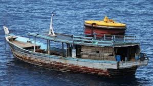
Get to Bali as a back load on an asylum seeker boat.
-
2
-
-
Yes. There are the extremities that operate in different time zones. Norfolk Island UTC + 11, Cocos Islands UTC + 6:30, but compared to the population of continental Australia, the populations of these places are minuscule. Norfolk Island 1748 residents, Cocos Island approximately 600 residents. A single time zone for Australia would hardly impose problems on these places.
The other argument has been related to the North-South differences in length of day. That is a fact that no amount of juggling with clock settings can alter.
-
Turbo - Where's the link?
-
Obviously in the situation where persons need to be extricated from wreckage, that overrides all other considerations, but if no one is in the wreckage, and fire has not started, stand guard and don't douse things unless fire breaks out. If you are dealing with an aircraft, you could turn the fuel cock to "OFF", as long as that action was reported to investigators. But are volunteer fire fighters taught where to look for fuel cocks in aircraft?

The Oaks airfield 'up for sale'
in AUS/NZ General Discussion
Posted
Apparently the heritage listing relates to the runway itself. I can't imagine that there is a concrete strip under the grass there, since The Oaks was a dispersal strip for Sydney's protecting fighters, usually based at Camden, Richmond, Bankstown and Hoxton Park. I don't think that Camden was often used for anything heavy. There was also another dispersal strip at Menangle.
Look at Hoxton Park. Any heritage value there went out the door pretty quick after the financiers got the lease.
Industrial development requires road infrastructure, and that has to be of a kind that makes heavy vehicle operation economic. The climb up to The Oaks from Glenmore is a fuel gulper for heavy vehicles. Also the sub surface of the road doesn't like 40 tonne behemoths.
As for Wollondilly Shire, they want six different forms, in triplicate, to get permission to develop a thirst. Trying to get them to agree with flood mitigation works would be a mighty challenge. Doing the actual work would be a snap.
I wonder how much the NIMBY who lives just north of the strip would scream if the noise level rose due to heavy vehicle traffic.